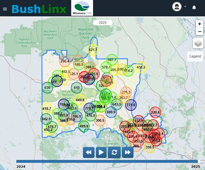
Access the soil moisture probe portal
Wimmera soil moisture and weather station network
Are you a dryland farmer, agronomist, plant breeder or with the emergency services? Did you know you can access the data and benefit from the Wimmera soil moisture probes and weather station network?
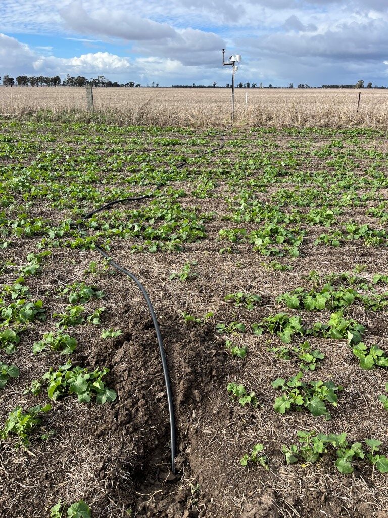
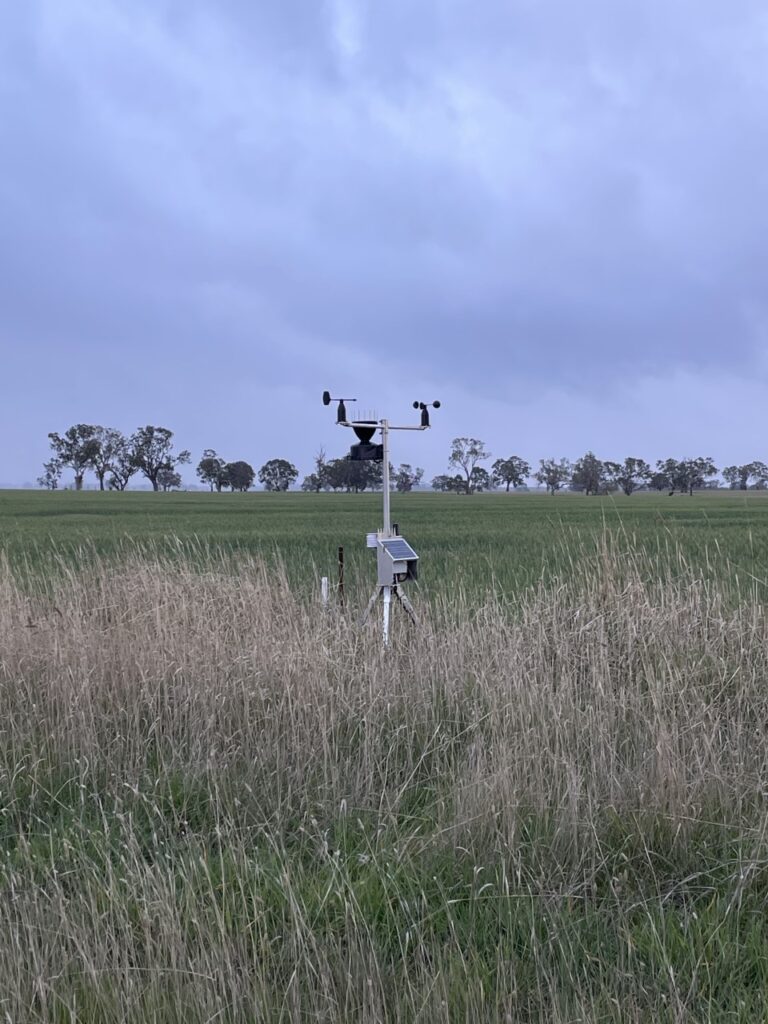
The stations collect readings for soil moisture, air temperature, soil temperate, dew point, DELTA T, humidity, wind direction, rainfall and detailed frost information. The information is easily accessed from a smartphone or computer.
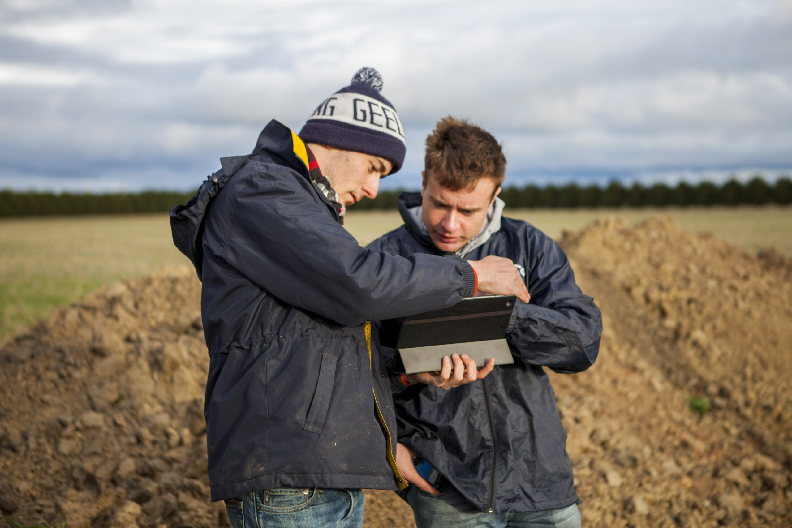
In 2023 Wimmera CMA installed an extra 72 soil moisture probes and weather stations across the Wimmera.
The region-wide installation of probes and stations across 30,000 square kilometres was done through funding from the Australian Government’s Future Drought Fund.
The network collects a broad range of data, presented in real time, that helps farmers manage risks and increase profitability.
How to access the data portal
- Go to this page, (http://wcma.vic.gov.au/soil-moisture-probe-portal) on our website.
- Create a FREE account by clicking Don’t have an account? Sign up.
- This will prompt you to create a user name and password, and ask for a few details such as your name, email address and phone number.
- Login with the username and password you created.
- Use the menu on the top left to select the resources tab. From here you can view a range of short and informative clips explaining how to use various elements of the data portal.
- Explore the site.
- If you need further assistance please contact the Wimmera Regional Agricultural Landcare Facilitator by emailing wcma@wcma.vic.gov.au or phone 03 5382 1544.
- You can also watch ‘how to’ videos which are in the Resources tab within the portal.
Other networks
The new stations complement other Wimmera networks such as those managed by Perennial Pasture Systems and Wonwondah Landcare Group. Download the Fact Sheets below for more information about what information cropping, pastures and livestock farmers can access and how to interpret it.
- Tapping into the Soil Moisture Portal
- Turning Data into Knowledge – Info Pastures and Livestock
- Turning Data into Knowledge – Info Cropping