Wimmera region
Our catchment
Our vision is for a healthy Wimmera catchment where a resilient landscape supports a sustainable and profitable community
The Wimmera region covers approximately 10% of Victoria and is the fifth largest catchment management region in Victoria, encompassing 2.3 million hectares.
The Regional Catchment Strategy (RCS) is the overarching strategy for integrated catchment management (ICM) in the Wimmera. It provides detailed information for our region. You can read it online.
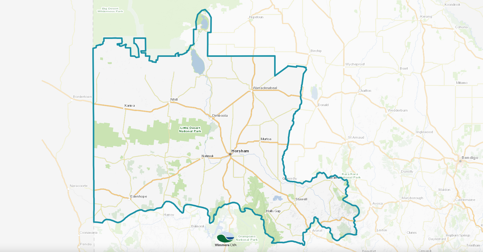
Click anywhere on the map to open the interactive Wimmera catchment map. How to use the interactive map
The Wimmera region includes the traditional lands of the Wotjobaluk, Jaadwa, Jadawadjali, Wergaia and Jpagulk People represented by the Barengi Gadjin Land Council Aboriginal Corporation and the Eastern Maar represented by Eastern Maar Aboriginal Corporation
Local Areas in the Wimmera region focus on distinct parts of the region:
- Hindmarsh
- Horsham
- West Wimmera
- Yarriambiack and Buloke
- Upper Catchment
(including parts of Ararat, Northern Grampians and Pyrenees local government areas).
Our connected systems
Wimmera’s natural resources are the building blocks of healthy and resilient environments and the focus of integrated catchment management.
Healthy and resilient environments rely on people working together to coordinate planning, investment and on-ground activities in an efficient and effective way to achieve a range of environmental, social, economic and cultural outcomes.
Rivers and streams, wetlands and groundwater all play an important part in providing economic, social, cultural and environmental benefits to the region.
The Wimmera contains 25% of Victoria’s wetlands.
Rivers & Streams in the Wimmera:
- The Wimmera Basin
- The eastern part of the Millicent Coast Basin
- The Barringgi Gadyin (Wimmera River)
- Gurru (Lake Hindmarsh)
- Ngalpakatia / Ngelpagutya (Lake Albacutya)
See the current River Flows Map
The Wotjobaluk, Jaadwa, Jadawadjali, Wergaia and Jupagalk people have stories handed down through their generations about the importance and value of the Wimmera River. Some of these stories are now shared here in River Yarns: http://arcg.is/2r8qXTA
Read more about the region’s water conditions, plans & actions in our online Regional Catchment Strategy:
The Wimmera is a biodiversity hotspot, supporting a range of habitats and species, nature- based tourism and local enjoyment.
The region is the geographical and biological transition between temperate and arid Australia.
Discover the Wimmera’s diverse flora and fauna:
Read more about region’s biodiversity plans & actions in our online Regional Catchment Strategy
Wimmera land and soils are important natural assets that underpin the region’s agricultural industry and valued natural landscapes. Find out more about:
Read more about region’s land & soil conditions and plans in our online regional Catchment Strategy
Active local people and communities are vital for ensuring the Wimmera’s land, water and biodiversity have a healthy future.
Every person and business that lives, works, recreates or has a special interest in the Wimmera uses and influences the natural environment. Human activity has the biggest influence on catchment condition.
Read more about region’s community conditions and plans in our online regional Catchment Strategy


