Publications & resources
Games
Learning about our Catchment and Water Quality
GTAV Resources
For more details see our Education page
If you would like to find more resources or information see https://www.gtav.asn.au/resources/secondary-resources-7-10
– Water in the World – Wimmera region case study – Year 7 Geography
See the GTAV website if you would like to find more resources or information on this Water in the World
– Place and Liveability – Wimmera region case study – Year 7 Geography
See the GTAV website if you would like to find more resources or information on this Place and Liveability
– First Nations Water in the World – Wimmera Region Case Study – Year 7 Geography
If you would like to find more resources or information see the GTAV website lesson First Nations Water in the World
Current Reports
Wimmera Floodplain Management Strategy PDF 5.34MB
Wimmera Floodplain Management Strategy-Midterm Implementation Report PDF 4.93MB
* The Wimmera River and Yarriambiack Creek Flow Modelling investigation undertook hydrologic and hydraulic modelling of the waterways between Glenorchy, Horsham, and Warracknabeal. The study assessed both current and ‘pre-European’ catchment-waterway-floodplain regimes.
Previous Reports
| Flood Map Locations | 1-in-5 year event | 1-in-10 year event | 1-in-20 year event | 1-in-50 year event | 1-in-100 year event | 1-in-200 year event |
| AEP Flood and Flow Events | ||||||
| Beulah 2006 | 10% | 5% | 2% | 1% | 0.5% | |
| Concongella 2015 | 20% | 10% | 5% | 2% | 1% | 0.5% |
| Dunmunkle 2017 – Rupanyup town post mitigation | 1% | |||||
| Dunmunkle 2017 – Boolite, Murtoa, Glenorchy & Upper Dunmunkle Creek | 20% | 10% | 5% | 2% | 1% | 0.5% |
| Halls Gap 2017 | 20% | 10% | 5% | 2% | 1% | 0.5% |
| Horsham-Wartook 2019 | 20% | 10% | 5% | 2% | 1% | 0.5% |
| Lower Wimmera 2016 – downstream of Horsham | 20% | 10% | 5% | 2% | 1% | 0.5% |
| Mount William Creek 2014 | 20% | 10% | 5% | 2% | 1% | 0.5% |
| Natimuk 2013 | 20% | 10% | 5% | 2% | 1% | 0.5% |
| Stawell 2024 | 1% | |||||
| Upper Wimmera 2014 | 20% | 10% | 5% | 2% | 1% | 0.5% |
| Wimmera River & Yarriambiack Creek 2009 (inc. Horsham) | 20% | 10% | 5% | 2% | 1% | 0.5% |
| Yarriambiack Creek 2016 – Brim | 20% | 10% | 5% | 2% | 1% | 0.5% |
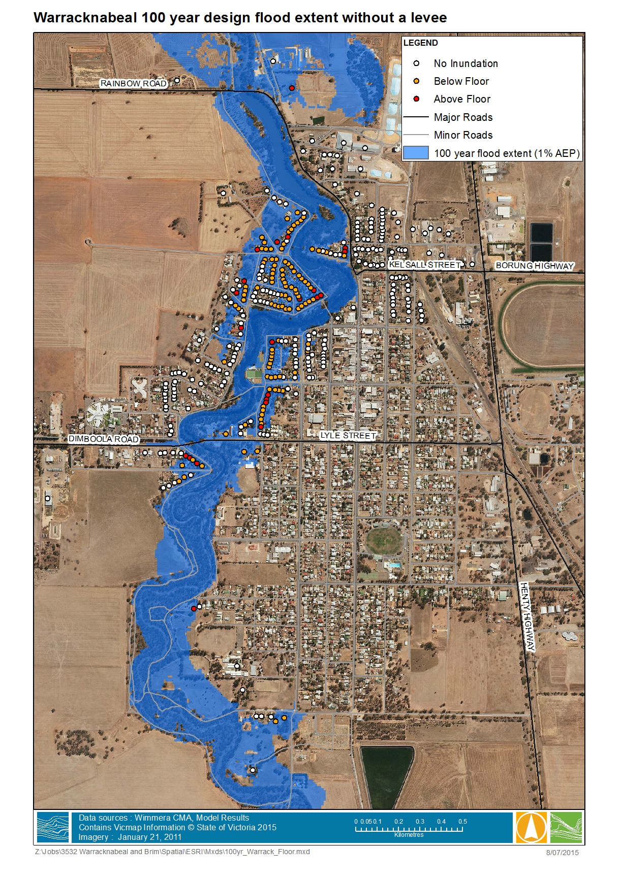
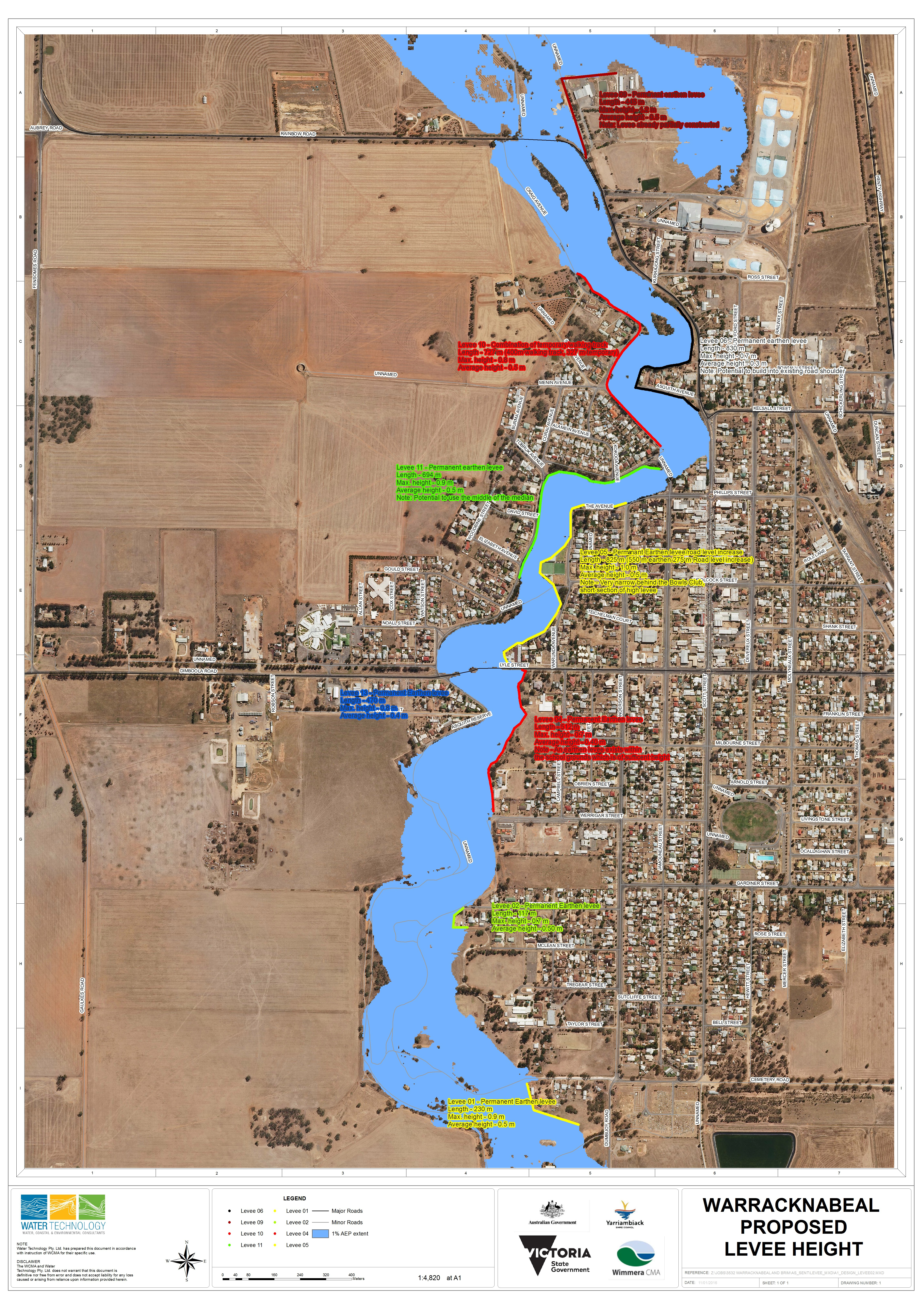
| Yarriambiack Creek 2016 – Warracknabeal | 20% | 10% | 5% | 2% | 1% | 0.5% |
| Yarriambiack Creek 2016 – Jung | 20% | 10% | 5% | 2% | 1% | 0.5% |
PLEASE NOTE: Maps are provided for general community information purposes only.
Flood levels and floor levels are determined from information available at a particular time and actual levels may exceed those shown. For information about flood conditions and restrictions affecting a particular property, contact Wimmera CMA or the relevant council. Neither Wimmera CMA nor the State of Victoria claim or warrant that the information in this map is accurate, complete or up to date, and neither Wimmera CMA nor the State shall be responsible or liable in respect of any use of or reliance placed on it by any person.
Please note these files contain higher quality details and are therefore large files.
AEP (Annual Exceedance Probability) Flood and Flow Event Extent Maps
| Flood Map Locations | 1-in-5 year event | 1-in-10 year event | 1-in-20 year event | 1-in-50 year event | 1-in-100 year event | 1-in-200 year event | 1-in-500 year event |
| AEP Flood and Flow Events | |||||||
| Beulah 2006 | 10% | 5% | 2% | 1% | 0.5% | ||
| Concongella 2015 | 20% | 10% | 5% | 2% | 1% | 0.5% | |
| Dunmunkle 2017 – Rupanyup town post mitigation | 1% | ||||||
| Dunmunkle 2017 – Boolite, Murtoa, Glenorchy & Upper Dunmunkle Creek | 20% | 10% | 5% | 2% | 1% | 0.5% | |
| Halls Gap 2017 | 20% | 10% | 5% | 2% | 1% | 0.5% | |
| Lower Wimmera 2016 – downstream of Horsham | 20% | 10% | 5% | 2% | 1% | 0.5% | 0.2% |
| Mount William Ck 2014 | 20% | 10% | 5% | 2% | 1% | 0.5% | |
| Natimuk 2013 | 20% | 10% | 5% | 2% | 1% | 0.5% | |
| Upper Wimmera 2014 | 20% | 10% | 5% | 2% | 1% | 0.5% | |
| Wimmera River & Yarriambiack Creek 2009 (inc. Horsham) | 20% | 10% | 5% | 2% | 1% | 0.5% | |
| Yarriambiack Creek 2016 – Brim | 20% | 10% | 5% | 2% | 1% | 0.5% | |
| Yarriambiack Creek 2016 – Warracknabeal | 20% | 10% | 5% | 2% | 1% | 0.5% | |
| Yarriambiack Creek 2016 – Jung | 20% | 10% | 5% | 2% | 1% | 0.5% |
PLEASE NOTE: Maps are provided for general community information purposes only.
Flood levels and floor levels are determined from information available at a particular time and actual levels may exceed those shown. For information about flood conditions and restrictions affecting a particular property, contact Wimmera CMA or the relevant council. Neither Wimmera CMA nor the State of Victoria claim or warrant that the information in this map is accurate, complete or up to date, and neither Wimmera CMA nor the State shall be responsible or liable in respect of any use of or reliance placed on it by any person.